Trail number
Not applicable
Trail length
Estimate about 30 kilometres of trails
Elevation variance
260 metres
Trail type
Single trail, fire trail
Trail surface
Smooth dirt, rocks and rock outcrops
Weather affected
Prone to be muddy after heavy rain
Trail condition sources
Nil
Trail features
Berms, jumps, drop offs
Trail obstacles
Log obstacles


Trail rating
Intermediate, Difficult, Extreme
Rating basis
Estimated
Night riding
Yes on the XC trails.
Family Friendly
Younger MTBers could rides some of the lower XC trails on this course but they should have suitable skill levels.
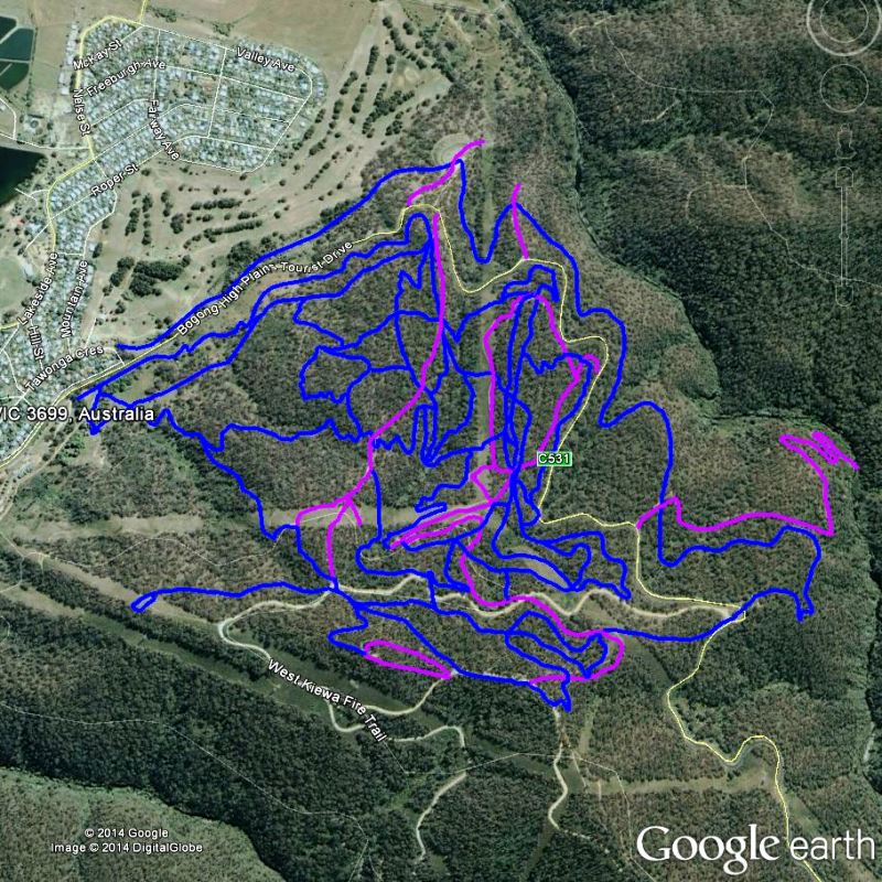
Click Image For Trail Map
No GPX download
As you can see from the map above there are a myriad of trails that can be ridden in this area. To give you a rough idea of the mix, the pink trails are fire trails or similar and the blue trails are singletrack. There is a summit in the middle of the network and the trails are spread right around it. We rode a number of trails on the western side and towards the summit. Generally these were XC style trails but there were a few we went past that were obviously DH oriented with massive jumps and / or drops. The bottom line is there is something in there for everyone and you readily spend a day wandering the trails.
Due to the sheer number of trails, I haven't taken photos of each but have made a mash up video of the trails ridden so you can get a feel for them.
 |
Parking is available at park entrance on Bogong High Plains Tourist Drive. |
|---|---|
 |
Toilet facilities are available at car park. |
 |
No drinking water is available. |
 |
No food or drinks are available in the immediate area. |
 |
No local information facilities are available. |